Up Khonburi Prev Next

 Previous image  At last page  Index page
IMG_7154
IMG_7155
IMG_7156
IMG_7158
khonburi_map3
  khonburi_map1.jpg  


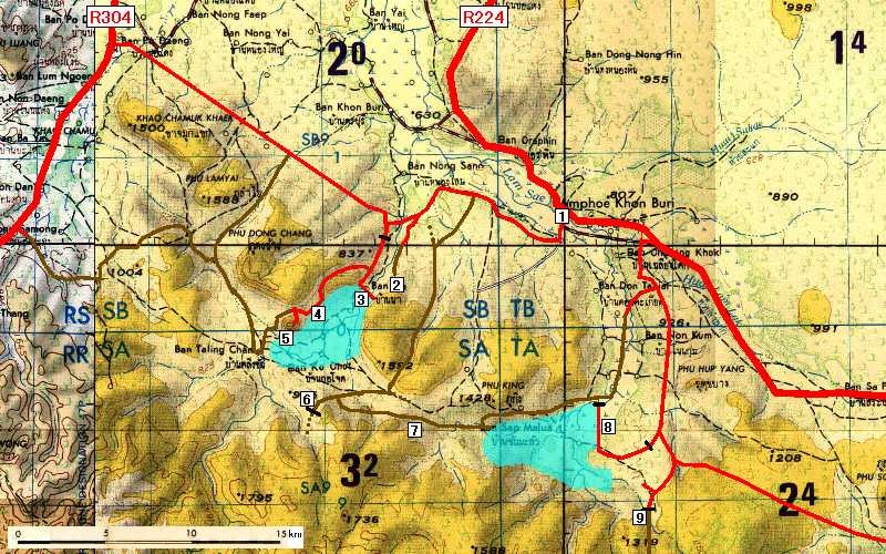
This map is shamefully taken from this website:

http://www.geocities.co.jp/Outdoors/6825/archive/khonburi.html

The explanation of the numbers on the map is as follows (text edited to my recent findings):

1. Khon Buri town
2. Monastery
3. Mun Bon Dam . As its name suggests, this dam is on the upstream Mun River which flows all the way to Ubon Ratchathani, then into the Mekong River.
4. Beach with a dozen restaurants and many parasols with chairs for hire, a popular weekend destination for local residents but do check your bill carefully afterwards.
5. Mountain, possibly an extinct volcano. There's a driveway leading to a mountainside monastery, from where you can climb up the cement stairs all the way to the mountaintop.
6. Forestry office . Beyond the closed gate, the dirt road continues.
7. possibly a cave
8. Lam Chae Dam, close to ban Map Krat. A rather difficult short dirt path connects the far end of the dam and the northern dirt road.
9. Thap Lan National Park / Third Park Management Unit Headquarters.